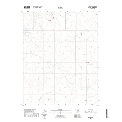
2018 Map of Kenton SE
USGS Topo · Published 2018About this map
Lake Carl Etling serves as a prominent focal point in this portion of Cimarron County, where the high plains landscape is defined by its drainage systems and deep cut ravines. The terrain is notably marked by Cottonwood Canyon and Water Canyon, which indicate the erosive forces at work in this part of the Oklahoma panhandle. Intermittent watercourses like S Carrizo Cr, Swede Cr, and Cold Springs Cr suggest a landscape where water is a precious and transformative resource. This 2018 survey illustrates a modern grid of rural roads, such as n0120 RD and e0094 RD, which navigate around the natural topography. The map detail reflects the ranching and agricultural character of the region, organized by the township and range lines of the Public Land Survey System.
Find a feature on this map
16 named features on this map. Tap any name to fly to it.
Don’t see what you’re looking for? This feature index may not catch every label — zoom into the map to look around manually.
Map Details
Editions of this 2018 Kenton SE Map
This is the sole edition of this map. No revisions or reprints were ever made.
Other maps of this area

1954 · Dalhart
USGS Topo · 1:250,000

1958 · Dalhart
USGS Topo · 1:250,000

1962 · Dalhart
USGS Topo · 1:250,000

1968 · Autograph Cliff NW
USGS Topo · 1:24,000

1968 · Kenton
USGS Topo · 1:24,000

1969 · Boise City NW
USGS Topo · 1:24,000

1969 · Wheeless
USGS Topo · 1:24,000

1969 · Felt NE
USGS Topo · 1:24,000

1969 · Kenton SE
USGS Topo · 1:24,000
1969 · Autograph Cliff
USGS Topo · 1:24,000