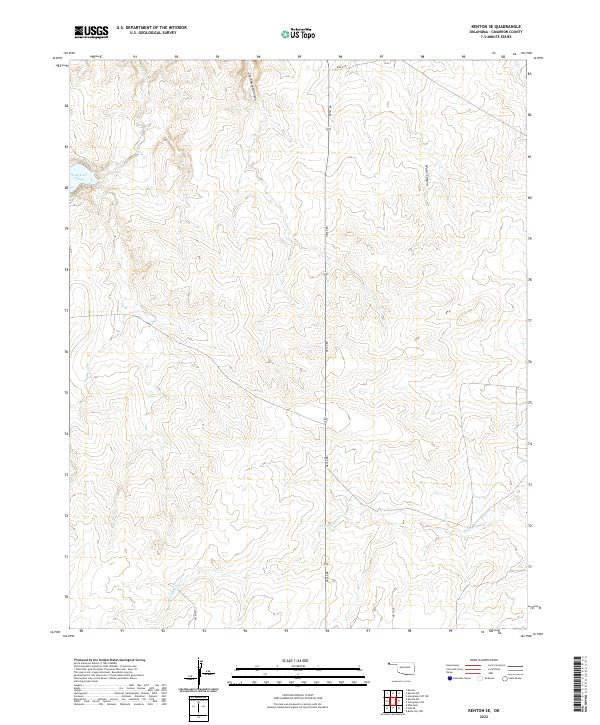
2022 Map of Kenton SE
USGS Topo · Published 2022About this map
Lake Carl Etling serves as a prominent landmark in this high-plains landscape of the Oklahoma Panhandle. The terrain is deeply incised by drainage systems such as S Carrizo Cr and Cold Springs Cr, which reveal the complex topography of the region's canyons. These geological features, including Cottonwood Canyon and Water Canyon, illustrate the erosional forces that have shaped Cimarron County over time. The map provides a clear picture of the rectangular survey system with township and range lines like t5n r2e and t4n r3e defining the jurisdictional layout. While modern infrastructure is represented by roads like n0120 RD, the primary character of the area remains defined by its natural watercourses, such as Swede Cr, and the isolated beauty of the western shortgrass prairie.
Find a feature on this map
16 named features on this map. Tap any name to fly to it.
Don’t see what you’re looking for? This feature index may not catch every label — zoom into the map to look around manually.
Map Details
Editions of this 2022 Kenton SE Map
This is the sole edition of this map. No revisions or reprints were ever made.
Other maps of this area

1954 · Dalhart
USGS Topo · 1:250,000

1958 · Dalhart
USGS Topo · 1:250,000

1962 · Dalhart
USGS Topo · 1:250,000

1968 · Autograph Cliff NW
USGS Topo · 1:24,000

1968 · Kenton
USGS Topo · 1:24,000

1969 · Boise City NW
USGS Topo · 1:24,000

1969 · Wheeless
USGS Topo · 1:24,000

1969 · Felt NE
USGS Topo · 1:24,000

1969 · Kenton SE
USGS Topo · 1:24,000
1969 · Autograph Cliff
USGS Topo · 1:24,000