
1969 Map of Kenton SE
USGS Topo · Published 1971About this map
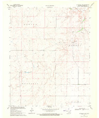
The Santa Fe Trail cuts across this high plains landscape in Cimarron County, Oklahoma, providing a clear visual record of one of America's most significant historical transit corridors. This 1969 field-checked survey highlights the rugged geography of the Kenton and Wheeless regions, where deep incisions like Cottonwood Canyon and Water Canyon drain toward the north. A prominent Historical Marker sits at a high point overlooking the southern drainage of Cold Springs Creek, signifying the enduring importance of this passage through the Panhandle.
Find a feature on this map
13 named features on this map. Tap any name to fly to it.
Don’t see what you’re looking for? This feature index may not catch every label — zoom into the map to look around manually.
Map Details
Editions of this 1969 Kenton SE Map
This is the sole edition of this map. No revisions or reprints were ever made.
Other maps of this area

1954 · Dalhart
USGS Topo · 1:250,000

1958 · Dalhart
USGS Topo · 1:250,000

1962 · Dalhart
USGS Topo · 1:250,000

1968 · Autograph Cliff NW
USGS Topo · 1:24,000

1968 · Kenton
USGS Topo · 1:24,000

1969 · Boise City NW
USGS Topo · 1:24,000

1969 · Wheeless
USGS Topo · 1:24,000

1969 · Felt NE
USGS Topo · 1:24,000
1969 · Autograph Cliff
USGS Topo · 1:24,000
1969 · Kenton NE
USGS Topo · 1:24,000