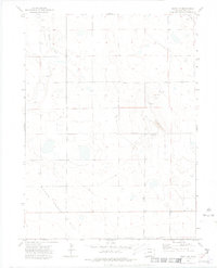
1972 Map of Keota NW
USGS Topo · Published 1974About this map
Seven Cross Hill dominates the southern landscape of this Weld County quadrangle, surveyed in the early 1970s. The terrain is defined by drainage patterns such as Jackson Draw and the winding course of Crow Creek, which cuts through the western sections of the map. While the area is largely characterized by its natural contours, small-scale industrial activity is evident through the presence of an Oil Well and multiple Gravel Pit sites. These features suggest a working landscape of extraction and ranching, where land use was tied closely to the underlying geology and water resources. The inclusion of fence lines, noted in the margin, further emphasizes the partitioned nature of this Colorado high plains environment during this era.
Find a feature on this map
6 named features on this map. Tap any name to fly to it.
Don’t see what you’re looking for? This feature index may not catch every label — zoom into the map to look around manually.
Map Details
Editions of this 1972 Keota NW Map
2 editions found
Other maps of this area

1954 · Greeley
USGS Topo · 1:250,000

1957 · Greeley
USGS Topo · 1:250,000

1958 · Greeley
USGS Topo · 1:250,000

1961 · Greeley
USGS Topo · 1:250,000

1964 · Greeley
USGS Topo · 1:250,000

1965 · Greeley
USGS Topo · 1:250,000

1972 · Dutch Girl Lake
USGS Topo · 1:24,000
1972 · Keota SE
USGS Topo · 1:24,000

1972 · Briggsdale
USGS Topo · 1:24,000

1972 · Keota NW
USGS Topo · 1:24,000