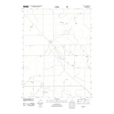
2011 Map of Keota
USGS Topo · Published 2011About this map
Keota serves as the central hub of this prairie landscape, where the distribution of water sources reveals the vital infrastructure of Colorado's High Plains. The map details an extensive network of named water-drawing sites, ranging from the uniquely titled Doublebarrel Windmill and Gunsight Windmill to the Big Pipe Windmill. These features, along with the Wildhorse Ditch and the Wildhorse Number 1 Dam at Wild Horse Reservoir 1, underscore the historic reliance on seasonal drainage and groundwater for local agriculture and livestock. The presence of the Coal Mine Windmill points toward earlier subsurface resource extraction in the region. Most travel through this section of Weld County is oriented along established routes like Co RD 105 and Co RD 100, which cut across the drainages of Wild Horse Creek.
Find a feature on this map
19 named features on this map. Tap any name to fly to it.
Don’t see what you’re looking for? This feature index may not catch every label — zoom into the map to look around manually.
Map Details
Editions of this 2011 Keota Map
This is the sole edition of this map. No revisions or reprints were ever made.
Other maps of this area

1954 · Sterling
USGS Topo · 1:250,000

1954 · Greeley
USGS Topo · 1:250,000

1957 · Greeley
USGS Topo · 1:250,000

1958 · Greeley
USGS Topo · 1:250,000

1958 · Sterling
USGS Topo · 1:250,000

1961 · Greeley
USGS Topo · 1:250,000

1964 · Greeley
USGS Topo · 1:250,000

1965 · Greeley
USGS Topo · 1:250,000

1972 · Dutch Girl Lake
USGS Topo · 1:24,000
1972 · Keota SE
USGS Topo · 1:24,000