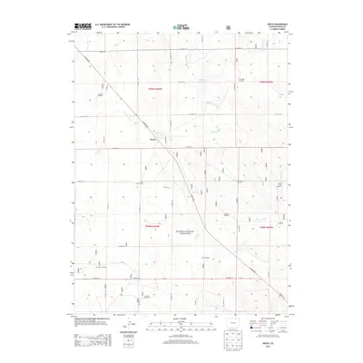
2013 Map of Keota
USGS Topo · Published 2013About this map
Keota stands as a primary point of reference in this High Plains landscape, situated at the intersection of Co Road 390 and Oswego Ave. Much of the surrounding territory is integrated into the Pawnee National Grassland, where the land's management for grazing and conservation is evident through a dense network of water infrastructure. The drainage of Wild Horse Creek and the Wild Horse Ditch feed into Wild Horse Reservoir 1, supporting the agricultural needs of the region.
Find a feature on this map
34 named features on this map. Tap any name to fly to it.
Don’t see what you’re looking for? This feature index may not catch every label — zoom into the map to look around manually.
Map Details
Editions of this 2013 Keota Map
This is the sole edition of this map. No revisions or reprints were ever made.
Other maps of this area

1954 · Sterling
USGS Topo · 1:250,000

1954 · Greeley
USGS Topo · 1:250,000

1957 · Greeley
USGS Topo · 1:250,000

1958 · Greeley
USGS Topo · 1:250,000

1958 · Sterling
USGS Topo · 1:250,000

1961 · Greeley
USGS Topo · 1:250,000

1964 · Greeley
USGS Topo · 1:250,000

1965 · Greeley
USGS Topo · 1:250,000

1972 · Dutch Girl Lake
USGS Topo · 1:24,000
1972 · Keota SE
USGS Topo · 1:24,000