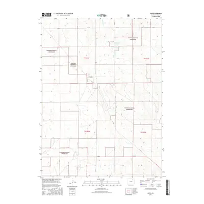
2016 Map of Keota
USGS Topo · Published 2016About this map
Keota and the surrounding high plains of Weld County are defined by the expansive Pawnee National Grassland, where the rectangular grid of the Public Land Survey System dictates the movement of travel and commerce. This map shows the rural character of the region in the early 21st century, centered on the small settlement of Keota and its nearby Keota Cem. The arid landscape is marked by seasonal water management, illustrated by Wild Horse Cr and the specialized Wildhorse Reservoir 1. This detailed topographic record is essential for understanding the modern distribution of ranching infrastructure and protected public lands in the northern Colorado shortgrass prairie.
Find a feature on this map
19 named features on this map. Tap any name to fly to it.
Don’t see what you’re looking for? This feature index may not catch every label — zoom into the map to look around manually.
Map Details
Editions of this 2016 Keota Map
This is the sole edition of this map. No revisions or reprints were ever made.
Other maps of this area

1954 · Sterling
USGS Topo · 1:250,000

1954 · Greeley
USGS Topo · 1:250,000

1957 · Greeley
USGS Topo · 1:250,000

1958 · Greeley
USGS Topo · 1:250,000

1958 · Sterling
USGS Topo · 1:250,000

1961 · Greeley
USGS Topo · 1:250,000

1964 · Greeley
USGS Topo · 1:250,000

1965 · Greeley
USGS Topo · 1:250,000

1972 · Dutch Girl Lake
USGS Topo · 1:24,000
1972 · Keota SE
USGS Topo · 1:24,000