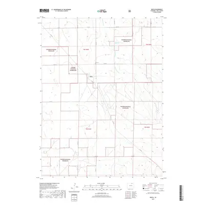
2019 Map of Keota
USGS Topo · Published 2019About this map
Keota and its surrounding high plains landscape are defined by the expansive Pawnee National Grassland, where the intersection of rural county roads like Co RD 100 and Co RD 103 mark the quiet grids of Weld County. The map provides a focused view of the small settlement of Keota, including the local Keota Cem, which serves as a significant marker for genealogical research and local history in this sparsely populated area. Hydrological features such as Wild Horse Cr and the Wild Horse Ditch suggest a landscape managed for water control, leading to the Wildhorse Reservoir 1. This 2019 survey documents the enduring ranching and conservation character of the region, where the section lines of t9n r60w and t8n r60w organize the vast, open terrain.
Find a feature on this map
19 named features on this map. Tap any name to fly to it.
Don’t see what you’re looking for? This feature index may not catch every label — zoom into the map to look around manually.
Map Details
Editions of this 2019 Keota Map
This is the sole edition of this map. No revisions or reprints were ever made.
Other maps of this area

1954 · Sterling
USGS Topo · 1:250,000

1954 · Greeley
USGS Topo · 1:250,000

1957 · Greeley
USGS Topo · 1:250,000

1958 · Greeley
USGS Topo · 1:250,000

1958 · Sterling
USGS Topo · 1:250,000

1961 · Greeley
USGS Topo · 1:250,000

1964 · Greeley
USGS Topo · 1:250,000

1965 · Greeley
USGS Topo · 1:250,000

1972 · Dutch Girl Lake
USGS Topo · 1:24,000
1972 · Keota SE
USGS Topo · 1:24,000