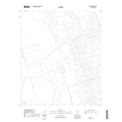
2019 Map of Kermit NW
USGS Topo · Published 2019About this map
Monument Draw cuts a subtle north-south path through this portion of the Permian Basin, a landscape defined by an extensive grid of service roads and industrial access points. The area northwest of Kermit shows a transition from open terrain to a highly organized network of local connectors such as Co Rd 101 and Capitan Rd. This 2019 survey documents the intricate geometry of oil and gas infrastructure, where hundreds of small spurs and pads are linked by routes like N FM 874. The lack of traditional residential clusters highlights the specialized industrial character of Winkler County, where transportation is dictated by resource extraction rather than settlement. Local researchers can trace the reach of named routes like Emu Rd and Co Rd 103 as they navigate the flat, engineered geography of the West Texas plains.
Find a feature on this map
9 named features on this map. Tap any name to fly to it.
Don’t see what you’re looking for? This feature index may not catch every label — zoom into the map to look around manually.
Map Details
Editions of this 2019 Kermit NW Map
This is the sole edition of this map. No revisions or reprints were ever made.
Other maps of this area

1954 · Hobbs
USGS Topo · 1:250,000

1954 · Pecos
USGS Topo · 1:250,000

1957 · Pecos
USGS Topo · 1:250,000

1958 · Hobbs
USGS Topo · 1:250,000

1969 · Jal
USGS Topo · 1:24,000

1969 · Jal SE
USGS Topo · 1:24,000

1970 · Cheyenne Draw
USGS Topo · 1:24,000

1970 · Wink North
USGS Topo · 1:24,000

1970 · Cheyenne Draw SE
USGS Topo · 1:24,000

1970 · Vesrue
USGS Topo · 1:24,000