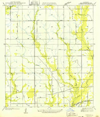
1949 Map of Kernan
USGS Topo · Published 1949About this map
The drainage basins of Wild Cow Creek and Cole Creek dominate this 1935 field examination, showing a landscape defined by its timber and rail history in Beauregard Parish. While the Missouri Pacific Railroad runs through the southeast corner near the settlement of Kernan, the interior of the sheet is crisscrossed by an extensive Old Logging Railroad Grade. These remnants of the lumber industry reveal the former paths of transport through the dense creek bottoms of Hickory Branch and Cowpen Creek.
Find a feature on this map
15 named features on this map. Tap any name to fly to it.
Don’t see what you’re looking for? This feature index may not catch every label — zoom into the map to look around manually.
Map Details
Editions of this 1949 Kernan Map
2 editions found

Other maps of this area

1935 · Gordon
USGS Topo · 1:31,680

1935 · Gaytine
USGS Topo · 1:31,680

1935 · Longville
USGS Topo · 1:31,680

1947 · Singer
USGS Topo · 1:31,680

1947 · Gaytine
USGS Topo · 1:31,680

1947 · DeQuincy
USGS Topo · 1:31,680

1947 · Oretta
USGS Topo · 1:31,680

1947 · Kernan
USGS Topo · 1:31,680

1947 · Longville
USGS Topo · 1:31,680

1947 · Beckwith School
USGS Topo · 1:31,680