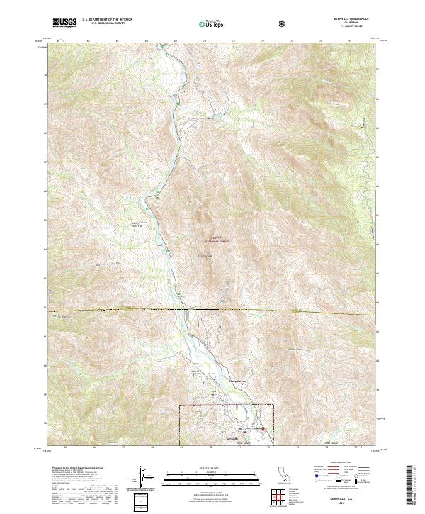
2021 Map of Kernville
USGS Topo · Published 2021About this map
The Kern River flows through a dramatic landscape within the Sequoia National Forest, defining the geography of this northern Kern County region. The community of Kernville serves as a primary hub at the southern edge of the map, where residential streets like Scodie Ave and Buena Vista Dr meet the foothills of the Sierra Nevada. Following the river north, the Sierra Way provides access to the Kern Wild and Scenic River corridor, passing landmarks such as Camp Owens and the northern settlement at Stormy Canyon Chico Flat. High-elevation features like Powers Peak and Baker Ridge offer a glimpse into the steep verticality of the terrain, while numerous drainage systems including Bull Run Cr and Cannell Cr feed into the central waterway.
Find a feature on this map
34 named features on this map. Tap any name to fly to it.
Don’t see what you’re looking for? This feature index may not catch every label — zoom into the map to look around manually.
Map Details
Editions of this 2021 Kernville Map
This is the sole edition of this map. No revisions or reprints were ever made.
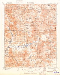
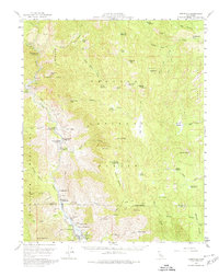
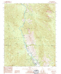
Historical Maps of Camp Owens Through Time
5 maps found