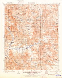
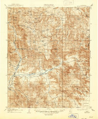
1908 Map of Kernville
USGS Topo · Published 1951About this map
The Kern River and its South Fork anchor this 1906 survey of the southern Sierra Nevada Mountains. The landscape is defined by a dense network of high-altitude meadows, including Big Meadow, Cannell Meadow, and Kennedy Meadows, which historically served as crucial summer grazing lands. Human settlement is concentrated along the river valleys at Kernville, Isabella, and Weldon, while the surrounding slopes reveal the region's extractive history through the Big Blue Mine and Bright Star Mine.
Find a feature on this map
86 named features on this map. Tap any name to fly to it.
Don’t see what you’re looking for? This feature index may not catch every label — zoom into the map to look around manually.
Map Details
Editions of this 1908 Kernville Map
6 editions found
Other maps of this area

1904 · Kaweah
USGS Topo · 1:125,000

1905 · Olancha
USGS Topo · 1:125,000

1905 · Fairview
USGS Topo · 1:24,000

1906 · Kernville
USGS Topo · 1:125,000

1907 · Olancha
USGS Topo · 1:125,000

1908 · Kernville
USGS Topo · 1:125,000

1908 · Ballarat
USGS Topo · 1:250,000

1909 · Kaweah
USGS Topo · 1:125,000

1913 · Ballarat
USGS Topo · 1:250,000

1914 · Caliente
USGS Topo · 1:125,000