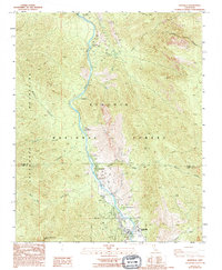
1986 Map of Kernville
USGS Topo · Published 1994About this map
The Kern River carves a deep valley through the Sequoia National Forest in this mid-1980s topographical study. Bordered by the Stormy Mountains to the west and the Greenhorn Mountains to the southwest, the landscape is defined by the sharp descent of numerous tributaries such as Corral Creek and Cannell Creek. The map documents the corridor of settlements and recreational sites along the river, including the mountain communities of Kernville, Riverkern, and Camp Owens.
Find a feature on this map
31 named features on this map. Tap any name to fly to it.
Don’t see what you’re looking for? This feature index may not catch every label — zoom into the map to look around manually.
Map Details
Editions of this 1986 Kernville Map
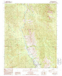
2 editions found
Other maps of this area

1905 · Fairview
USGS Topo · 1:24,000

1906 · Kernville
USGS Topo · 1:125,000

1908 · Kernville
USGS Topo · 1:125,000

1918 · Fairview
USGS Topo · 1:31,680

1920 · Delonagha
USGS Topo · 1:62,500

1926 · Glennville
USGS Topo · 1:62,500

1936 · Tobias Peak
USGS Topo · 1:125,000

1943 · Tobias Peak
USGS Topo · 1:125,000

1943 · Isabella
USGS Topo · 1:62,500

1945 · Tobias Peak
USGS Topo · 1:62,500