
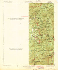
1943 Map of Tobias Peak
USGS Topo · Published 1943About this map
Tule River Indian Reservation and Sequoia National Forest dominate this 1943 study of the southern Sierra Nevada foothills. The landscape is a network of ridges and meadows where the Kern and White Rivers originate. Early mountain settlements like Glennville and Posey serve as hubs for the scattered family-named landmarks including Pettit Ranch. The map captures a transitional era for the local economy, where established ranching interests exist alongside the extraction infrastructure of the Tungsten Mine and Lone Star Mine.
Find a feature on this map
98 named features on this map. Tap any name to fly to it.
Don’t see what you’re looking for? This feature index may not catch every label — zoom into the map to look around manually.
Map Details
Editions of this 1943 Tobias Peak Map
2 editions found
Other maps of this area

1904 · Kaweah
USGS Topo · 1:125,000

1905 · Olancha
USGS Topo · 1:125,000

1905 · Fairview
USGS Topo · 1:24,000

1906 · Bakersfield
USGS Topo · 1:62,500

1906 · Kernville
USGS Topo · 1:125,000

1907 · Olancha
USGS Topo · 1:125,000

1908 · Kernville
USGS Topo · 1:125,000

1909 · Kaweah
USGS Topo · 1:125,000

1910 · Buena Vista Lake
USGS Topo · 1:125,000

1912 · Buena Vista Lake
USGS Topo · 1:125,000
Featured Places
- Lackey Place, CA
- Shirley Meadows, CA
- Guernsey Mill, CA
- Johnsondale, CA
- Spear Creek Summer Home Tract, CA