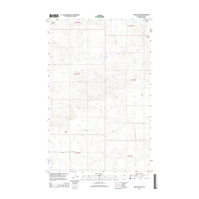
2014 Map of Kerr Cow Camp
USGS Topo · Published 2014About this map
Kerr Cow Camp sits as a primary human landmark in this section of Valley County, Montana, characterized by a sparse network of ranching roads and shifting seasonal drainages. The landscape is defined by its topographic extremes, from the level expanse of Kansas Flats in the northeast to the deeply incised drainage of Long Coulee in the southwest. Local water sources like S Fork Bitter Cr, Chisholm Cr, and Buggy Cr dictate the layout of the terrain, carving paths through the high plains. A few identified routes, including Britch Rd and Kerr Rd, provide the only modern access through this territory, which is partitioned by the Public Land Survey System into townships like t34n r38e. This 2014 survey documents a region where the land use remains tied to expansive cattle grazing and the natural flow of the watershed.
Find a feature on this map
16 named features on this map. Tap any name to fly to it.
Don’t see what you’re looking for? This feature index may not catch every label — zoom into the map to look around manually.
Map Details
Editions of this 2014 Kerr Cow Camp Map
This is the sole edition of this map. No revisions or reprints were ever made.
Other maps of this area

1919 · Boundary
USGS Topo · 1:125,000

1954 · Glasgow
USGS Topo · 1:250,000

1957 · Glasgow
USGS Topo · 1:250,000

1958 · Glasgow
USGS Topo · 1:250,000

1984 · O'Juel Lake
USGS Topo · 1:24,000

1984 · Laundry Hill
USGS Topo · 1:24,000

1984 · Opheim
USGS Topo · 1:100,000

1984 · Gay Dam
USGS Topo · 1:24,000

1984 · Dodge Reservoir
USGS Topo · 1:24,000

1984 · Last Chance Reservoir
USGS Topo · 1:24,000