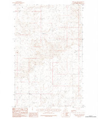
1984 Map of Kerr Cow Camp
USGS Topo · Published 1984About this map
Kerr Cow Camp serves as a lone point of settlement in this northern Montana landscape, situated near the headwaters of Buggy Creek. The terrain is defined by a dendritic drainage pattern typical of the region's high plains, where seasonal watercourses like Long Coulee and Willow Creek have carved intricate branching networks into the land. The proximity of Chisholm Creek further suggests a landscape historically utilized for livestock grazing and open-range ranching. This provisional survey captures the area as it was recorded in the mid-1970s and early 1980s, revealing the intersection of township boundaries across a sparsely populated territory where water sources and topography dictated the placement of camps and trails.
Find a feature on this map
7 named features on this map. Tap any name to fly to it.
Don’t see what you’re looking for? This feature index may not catch every label — zoom into the map to look around manually.
Map Details
Editions of this 1984 Kerr Cow Camp Map
This is the sole edition of this map. No revisions or reprints were ever made.
Other maps of this area

1919 · Boundary
USGS Topo · 1:125,000

1954 · Glasgow
USGS Topo · 1:250,000

1957 · Glasgow
USGS Topo · 1:250,000

1958 · Glasgow
USGS Topo · 1:250,000

1984 · O'Juel Lake
USGS Topo · 1:24,000

1984 · Laundry Hill
USGS Topo · 1:24,000

1984 · Opheim
USGS Topo · 1:100,000

1984 · Gay Dam
USGS Topo · 1:24,000

1984 · Dodge Reservoir
USGS Topo · 1:24,000

1984 · Last Chance Reservoir
USGS Topo · 1:24,000