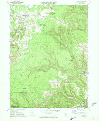
1970 Map of Kersey
USGS Topo · Published 1972About this map
Extensive industrial activity defines this portion of Elk County, where numerous Strip Mines are interspersed among the dense woodlands of Moshannon State Forest and Elk State Forest. The settlement pattern reflects the area's extraction history, centered on nodes like Dagus Mines and Coal Hollow, while the Penn Central railroad follows the curve of Bennett Branch through the southeastern corner at Force.
Find a feature on this map
45 named features on this map. Tap any name to fly to it.
Don’t see what you’re looking for? This feature index may not catch every label — zoom into the map to look around manually.
Map Details
Editions of this 1970 Kersey Map
3 editions found
Other maps of this area

1929 · Clearfield
USGS Topo · 1:48,000

1929 · Penfield
USGS Topo · 1:62,500

1932 · Clearfield
USGS Topo · 1:62,500

1932 · Penfield
USGS Topo · 1:62,500

1941 · Benezette
USGS Topo · 1:62,500

1941 · Ridgway
USGS Topo · 1:62,500

1943 · Benezette
USGS Topo · 1:62,500

1944 · Ridgway
USGS Topo · 1:62,500

1957 · Warren
USGS Topo · 1:250,000

1958 · Warren
USGS Topo · 1:250,000
Featured Places
- Fox Township, PA
- Coal Hollow, Fox Township
- Kersey, Fox Township
- Dagus Mines, Fox Township
- Jay Township, PA