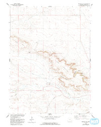
1960 Map of Kessler Gap
USGS Topo · Published 1993About this map
Bear Mountain dominates the landscape of this Goshen County corner, a topographic barrier cut by the distinctive passage of Kessler Gap. This 1960 field-checked survey reveals an intricate network of irrigation and water management essential to the high plains, including the Kessler Ditch, Bear Creek Ditch, and Lovercheck Ditch. These man-made channels follow the natural drainages of Bear Creek and its tributaries, supporting the agricultural life of the region.
Find a feature on this map
15 named features on this map. Tap any name to fly to it.
Don’t see what you’re looking for? This feature index may not catch every label — zoom into the map to look around manually.
Map Details
Editions of this 1960 Kessler Gap Map
3 editions found
Other maps of this area

1899 · Goshen Hole
USGS Topo · 1:125,000

1954 · Cheyenne
USGS Topo · 1:250,000

1958 · Cheyenne
USGS Topo · 1:250,000

1960 · Diamond Flat
USGS Topo · 1:24,000

1960 · Petsch Reservoir
USGS Topo · 1:24,000

1960 · Hawk Springs
USGS Topo · 1:24,000

1960 · Needle Rock
USGS Topo · 1:24,000

1960 · Rocky Hollow
USGS Topo · 1:24,000

1960 · Kessler Gap
USGS Topo · 1:24,000

1960 · Meriden
USGS Topo · 1:24,000