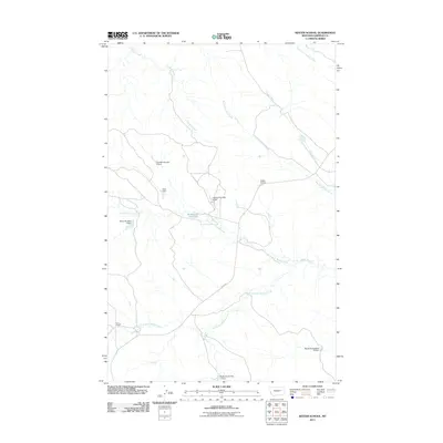
2011 Map of Kester School
USGS Topo · Published 2011About this map
Kester School and Binion Ranch anchor this landscape in Garfield County, reflecting the sparse ranching and rural education infrastructure of the Montana plains. The terrain is defined by a dense network of intermittent drainage systems, including the headwaters of Crooked Creek and Woody Creek. Water management is central to the area's utility, evidenced by several numeric dam projects such as Claribell Number 5 Dam, Claribell Number 6 Dam, and the Big Bucks Number 13 Dam. These small-scale impoundments, alongside features like Buffalo Hill Reservoir, show the critical importance of stock water and irrigation in this high-plains environment. Haxby Rd provides the primary transit artery through the region, connecting remote homesteads and agricultural sites across the prairie.
Find a feature on this map
18 named features on this map. Tap any name to fly to it.
Don’t see what you’re looking for? This feature index may not catch every label — zoom into the map to look around manually.
Map Details
Editions of this 2011 Kester School Map
This is the sole edition of this map. No revisions or reprints were ever made.
Other maps of this area

1954 · Jordan
USGS Topo · 1:250,000

1956 · Jordan
USGS Topo · 1:250,000

1958 · Jordan
USGS Topo · 1:250,000

1958 · Maloney Hill
USGS Topo · 1:62,500

1964 · Jordan
USGS Topo · 1:250,000

1964 · Jordan NE
USGS Topo · 1:24,000

1964 · Bateman Coulee
USGS Topo · 1:24,000

1964 · Bateman Coulee NE
USGS Topo · 1:24,000
1972 · Kester School
USGS Topo · 1:24,000
1972 · Gilbert Creek SE
USGS Topo · 1:24,000