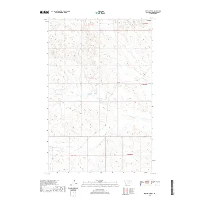
2020 Map of Kester School
USGS Topo · Published 2020About this map
Kester School serves as a lone institutional landmark in this expansive Garfield County landscape, situated near the headwaters of the S Fork Pass Cr. The map reveals a complex network of ephemeral drainage systems and ranching infrastructure, most notably the Buffalo Hill Reservoir nestled between the various forks of Woody Cr. To the north, the prominent Piney Buttes overlook the winding course of Crooked Cr and its eastern tributary.
Find a feature on this map
19 named features on this map. Tap any name to fly to it.
Don’t see what you’re looking for? This feature index may not catch every label — zoom into the map to look around manually.
Map Details
Editions of this 2020 Kester School Map
This is the sole edition of this map. No revisions or reprints were ever made.
Other maps of this area

1954 · Jordan
USGS Topo · 1:250,000

1956 · Jordan
USGS Topo · 1:250,000

1958 · Jordan
USGS Topo · 1:250,000

1958 · Maloney Hill
USGS Topo · 1:62,500

1964 · Jordan
USGS Topo · 1:250,000

1964 · Jordan NE
USGS Topo · 1:24,000

1964 · Bateman Coulee
USGS Topo · 1:24,000

1964 · Bateman Coulee NE
USGS Topo · 1:24,000
1972 · Kester School
USGS Topo · 1:24,000
1972 · Gilbert Creek SE
USGS Topo · 1:24,000