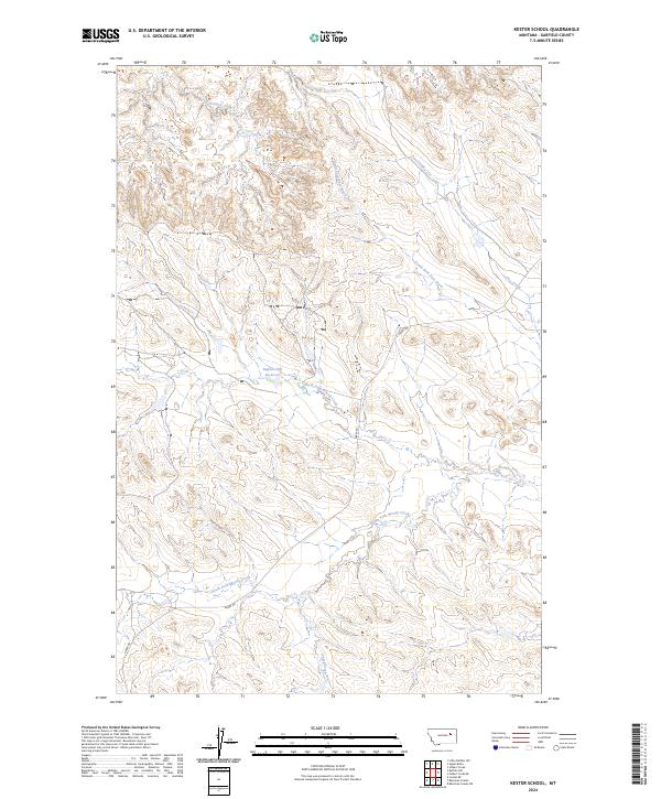
2024 Map of Kester School
USGS Topo · Published 2024About this map
Buffalo Hill and its namesake Buffalo Hill Reservoir serve as the central landmarks in this high plains landscape of Garfield County. This 2024 USGS topograhic survey documents a remote ranching and grazing region defined by a complex drainage system that feeds into the surrounding Missouri River breaks. The intermittent waters of Woody Creek, including the North Fork Woody Creek and South Fork Woody Creek, carve deep into the terrain, illustrating the hydrologic patterns of the northern Montana prairie. Haxby Rd provides the primary north-south passage through the area, connecting isolated sections of rangeland. The map detail reflects the enduring agricultural character of the region, where water management features like the reservoir are critical to the land's utility. Other drainage systems, such as Pass Creek and Crooked Creek, further delineate the topographic relief of this sparsely populated section of the state.
Find a feature on this map
16 named features on this map. Tap any name to fly to it.
Don’t see what you’re looking for? This feature index may not catch every label — zoom into the map to look around manually.
Map Details
Editions of this 2024 Kester School Map
This is the sole edition of this map. No revisions or reprints were ever made.
Other maps of this area

1954 · Jordan
USGS Topo · 1:250,000

1956 · Jordan
USGS Topo · 1:250,000

1958 · Jordan
USGS Topo · 1:250,000

1958 · Maloney Hill
USGS Topo · 1:62,500

1964 · Jordan
USGS Topo · 1:250,000

1964 · Jordan NE
USGS Topo · 1:24,000

1964 · Bateman Coulee
USGS Topo · 1:24,000

1964 · Bateman Coulee NE
USGS Topo · 1:24,000
1972 · Kester School
USGS Topo · 1:24,000
1972 · Gilbert Creek SE
USGS Topo · 1:24,000