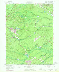
1957 Map of Keswick Grove
USGS Topo · Published 1971About this map
The New Jersey Pine Barrens define this landscape, where the shifting boundaries of Manchester, Dover, Berkeley, and Lacey meet amidst a dense network of tributaries. The economy of the mid-20th century is clearly visible through the extensive cultivation of Cranberry Bogs, including the substantial Dover Cranberry Bog and several unnamed operations along Wranget Brook and Green Branch. These wetlands are juxtaposed with the transit infrastructure of the Central Railroad of New Jersey and the Penn Central, which cut through the sandy plains.
Find a feature on this map
39 named features on this map. Tap any name to fly to it.
Don’t see what you’re looking for? This feature index may not catch every label — zoom into the map to look around manually.
Map Details
Editions of this 1957 Keswick Grove Map
Other maps of this area

1884 · Whitings
USGS Topo · 1:62,500

1888 · Barnegat
USGS Topo · 1:62,500

1888 · Asbury Park
USGS Topo · 1:62,500

1888 · Cassville
USGS Topo · 1:62,500

1888 · Whitings
USGS Topo · 1:62,500

1893 · Asbury Park
USGS Topo · 1:62,500

1893 · Barnegat
USGS Topo · 1:62,500

1894 · Cassville
USGS Topo · 1:62,500

1898 · Barnegat
USGS Topo · 1:62,500

1900 · Cassville
USGS Topo · 1:62,500
Featured Places
- Toms River, NJ
- Manchester Township, NJ
- Berkeley Township, NJ
- Lacey Township, NJ
- Crestwood Village, Manchester Township