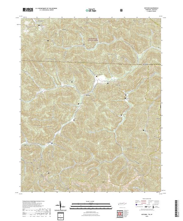
2022 Map of Ketchen
USGS Topo · Published 2022About this map
Ketchen and the northern reaches of the Daniel Boone National Forest define this landscape along the state line where Tennessee meets Kentucky. The topography is dominated by a complex network of ridges and hollows, where family history is deeply etched into the land through numerous small burial grounds including Blankenship Cem, Trammel Cem, and Cross Cem. Movement through the area follows the natural corridors of the Capuchin Cr and Jellico Cr watersheds. Local life centers on these narrow valley floors, where the settlement of Creekmore sits near the headwaters of Hayes Cr. The map reveals a land divided by significant boundaries, including the meeting point of McCreary Co, Scott Co, and Campbell Co, reflecting a history of isolated mountain communities defined by both state and county lines.
Find a feature on this map
84 named features on this map. Tap any name to fly to it.
Don’t see what you’re looking for? This feature index may not catch every label — zoom into the map to look around manually.
Map Details
Editions of this 2022 Ketchen Map
This is the sole edition of this map. No revisions or reprints were ever made.
Other maps of this area

1890 · Williamsburg
USGS Topo · 1:125,000

1893 · Briceville
USGS Topo · 1:125,000

1894 · Williamsburg
USGS Topo · 1:125,000

1895 · Briceville
USGS Topo · 1:125,000

1896 · Briceville
USGS Topo · 1:125,000

1936 · Ivydell
USGS Topo · 1:24,000

1936 · Pioneer
USGS Topo · 1:24,000

1936 · La Follette
USGS Topo · 1:48,000
1946 · Ivydell
USGS Topo · 1:24,000
1946 · Pioneer
USGS Topo · 1:24,000