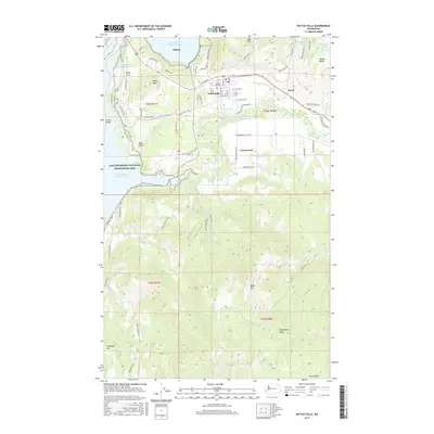
2017 Map of Kettle Falls
USGS Topo · Published 2017About this map
Kettle Falls and its surrounding terrain are defined by the expansive Franklin D Roosevelt Lake, part of the Lake Roosevelt National Recreation Area. The landscape transitions from the developed streets of the town toward the high elevations of the Huckleberry Range and Mingo Mtn to the south. Local water management and industrial history are evident through the Meyers Falls Reservoir and the Boise Cascade Mill Waste Pond near Peach Crest. Genealogists and local historians can locate the Meyers Falls Cem and trace the rural settlements of Greenwood and Ward. The Colville River flows through the center of the sheet, feeding into the larger reservoir system. This survey captures a modern look at the area's mix of recreation, forestry infrastructure, and high-relief geography, including named points like Hawks Nest and Heidegger Hill.
Find a feature on this map
80 named features on this map. Tap any name to fly to it.
Don’t see what you’re looking for? This feature index may not catch every label — zoom into the map to look around manually.
Map Details
Editions of this 2017 Kettle Falls Map
This is the sole edition of this map. No revisions or reprints were ever made.
Other maps of this area

1927 · Chewelah
USGS Topo · 1:125,000

1929 · Colville
USGS Topo · 1:125,000

1930 · Chewelah
USGS Topo · 1:125,000

1933 · Colville
USGS Topo · 1:125,000

1936 · Marcus
USGS Topo · 1:96,000

1942 · Marcus
USGS Topo · 1:125,000

1948 · Kettle Falls
USGS Topo · 1:62,500

1950 · Inchelium
USGS Topo · 1:62,500

1951 · Kettle Falls
USGS Topo · 1:62,500

1952 · Echo Valley
USGS Topo · 1:24,000