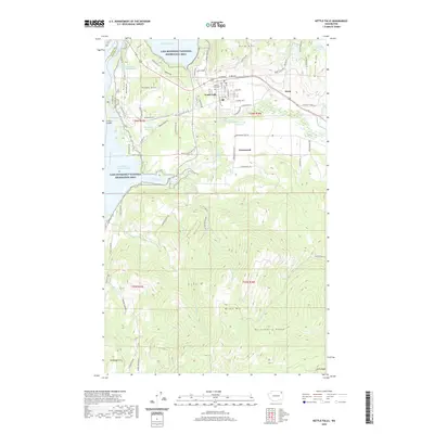
2020 Map of Kettle Falls
USGS Topo · Published 2020About this map
Kettle Falls serves as the primary hub of this 2020 landscape, situated at the junction of the Colville River and the expansive Franklin D Roosevelt Lake. The topography is defined by the steep elevation changes of the Huckleberry Range and Mingo Mtn, which overlook the river valleys. Industrial and civic elements are clearly marked, including the Boise Cascade Mill Waste Pond near the northern boundary and the historic Meyers Falls Cem located just east of the main town site.
Find a feature on this map
74 named features on this map. Tap any name to fly to it.
Don’t see what you’re looking for? This feature index may not catch every label — zoom into the map to look around manually.
Map Details
Editions of this 2020 Kettle Falls Map
This is the sole edition of this map. No revisions or reprints were ever made.
Other maps of this area

1927 · Chewelah
USGS Topo · 1:125,000

1929 · Colville
USGS Topo · 1:125,000

1930 · Chewelah
USGS Topo · 1:125,000

1933 · Colville
USGS Topo · 1:125,000

1936 · Marcus
USGS Topo · 1:96,000

1942 · Marcus
USGS Topo · 1:125,000

1948 · Kettle Falls
USGS Topo · 1:62,500

1950 · Inchelium
USGS Topo · 1:62,500

1951 · Kettle Falls
USGS Topo · 1:62,500

1952 · Echo Valley
USGS Topo · 1:24,000