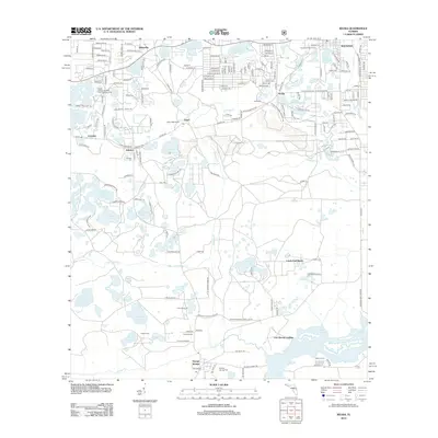
2012 Map of Keuka
USGS Topo · Published 2012About this map
Interlachen and the surrounding lake country of Putnam County are defined by a dense network of water bodies, including Lake Galilee, Morris Lake, and Lake Lagonda. This 2012 survey captures the transitional landscape between established lakeside communities and the wetlands surrounding Lake Ocklawaha. Small settlements like Keuka, Edgar, and Whiteville are connected by a web of local roads, while industrial activity is noted near the Keuka Sand Mine Entrance Rd. For local history researchers, the map identifies several significant burying grounds, such as Keuka Cem, Johnson Cem, and Orange Springs Cem. The southern reach of the quadrangle shows the riparian environment of Orange Cr and Fort Brook Landing, alongside specialized sites like the South Atlantic Seventh-Day Adventist Camp.
Find a feature on this map
118 named features on this map. Tap any name to fly to it.
Don’t see what you’re looking for? This feature index may not catch every label — zoom into the map to look around manually.
Map Details
Editions of this 2012 Keuka Map
This is the sole edition of this map. No revisions or reprints were ever made.
Other maps of this area

1893 · Citra
USGS Topo · 1:62,500

1895 · Citra
USGS Topo · 1:62,500

1915 · Interlachen
USGS Topo · 1:48,000

1916 · Interlachen
USGS Topo · 1:62,500

1938 · Hawthorn
USGS Topo · 1:48,000

1943 · Hawthorn
USGS Topo · 1:62,500

1944 · Interlachen
USGS Topo · 1:62,500

1949 · Keuka
USGS Topo · 1:24,000

1949 · Baywood
USGS Topo · 1:24,000

1949 · Rodman
USGS Topo · 1:24,000