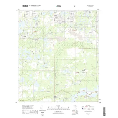
2018 Map of Keuka
USGS Topo · Published 2018About this map
Orange Springs and the northern reaches of the Ocala National Forest anchor this landscape along the border of Putnam and Marion counties. The terrain is defined by a high density of freshwater features, ranging from the large Lake Ocklawaha in the south to a network of smaller named bodies like Lake Keuka, Lake Galilee, and Darkwater Lake. These lakes are interspersed with small settlements such as Interlachen, Edgar, and Keuka, reflecting a community structure tied closely to the region's hydrography.
Find a feature on this map
108 named features on this map. Tap any name to fly to it.
Don’t see what you’re looking for? This feature index may not catch every label — zoom into the map to look around manually.
Map Details
Editions of this 2018 Keuka Map
This is the sole edition of this map. No revisions or reprints were ever made.
Other maps of this area

1893 · Citra
USGS Topo · 1:62,500

1895 · Citra
USGS Topo · 1:62,500

1915 · Interlachen
USGS Topo · 1:48,000

1916 · Interlachen
USGS Topo · 1:62,500

1938 · Hawthorn
USGS Topo · 1:48,000

1943 · Hawthorn
USGS Topo · 1:62,500

1944 · Interlachen
USGS Topo · 1:62,500

1949 · Keuka
USGS Topo · 1:24,000

1949 · Baywood
USGS Topo · 1:24,000

1949 · Rodman
USGS Topo · 1:24,000