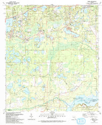
1993 Map of Keuka
USGS Topo · Published 1993About this map
Interlachen and the surrounding lake country of Putnam County appear here in a period of established rural settlement and recreation. The northern portion of the map is densely populated with small lakeside communities like Keuka and Whiteville, where a grid of streets including Amsterdam St and Rhine St meets the shores of Lake Galilee and Lady Slipper Lake. To the south, the landscape transitions into the northern reaches of the Ocala National Forest, bordered by the winding Ocklawaha River and its associated wetlands.
Find a feature on this map
75 named features on this map. Tap any name to fly to it.
Don’t see what you’re looking for? This feature index may not catch every label — zoom into the map to look around manually.
Map Details
Editions of this 1993 Keuka Map
This is the sole edition of this map. No revisions or reprints were ever made.
Other maps of this area

1893 · Citra
USGS Topo · 1:62,500

1895 · Citra
USGS Topo · 1:62,500

1915 · Interlachen
USGS Topo · 1:48,000

1916 · Interlachen
USGS Topo · 1:62,500

1938 · Hawthorn
USGS Topo · 1:48,000

1943 · Hawthorn
USGS Topo · 1:62,500

1944 · Interlachen
USGS Topo · 1:62,500

1949 · Keuka
USGS Topo · 1:24,000

1949 · Baywood
USGS Topo · 1:24,000

1949 · Rodman
USGS Topo · 1:24,000