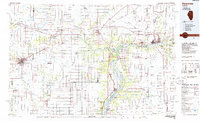
1985 Map of Kewanee
USGS Topo · Published 1985About this map
Kewanee and Princeton anchor this 1985 survey of north-central Illinois, a region defined by the convergence of major water routes and railway corridors. The Illinois River snakes through the eastern half of the map, flanked by a network of protected lands such as Starved Rock State Park and Donnelley State Fish and Wildlife Area. This era shows the landscape’s transition into a modern recreational and agricultural hub, with the Hennepin Canal Parkway providing a historical transit corridor that parallels modern highways like Interstate 80.
Find a feature on this map
189 named features on this map. Tap any name to fly to it.
Don’t see what you’re looking for? This feature index may not catch every label — zoom into the map to look around manually.
Map Details
Editions of this 1985 Kewanee Map
2 editions found
Other maps of this area

1892 · Ottawa
USGS Topo · 1:62,500

1893 · Lacon
USGS Topo · 1:62,500

1893 · Hennepin
USGS Topo · 1:62,500

1893 · Metamora
USGS Topo · 1:62,500

1893 · Dunlap
USGS Topo · 1:62,500

1893 · Lasalle
USGS Topo · 1:62,500

1898 · Dunlap
USGS Topo · 1:62,500

1899 · Clinton
USGS Topo · 1:125,000

1909 · Hennepin
USGS Topo · 1:62,500

1911 · La Salle
USGS Topo · 1:62,500