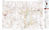
1985 Map of Kewanee
USGS Topo · Published 1989About this map
Kewanee and Princeton anchor this mid-1980s landscape, where the agricultural grid of Central Illinois meets the complex hydrology of the Illinois River valley. The map documents a critical corridor of transport and conservation, following the path of the Hennepin Canal as it traverses through towns like Wyanet and Sheffield. This waterway, protected as the Hennepin Canal Parkway State Park, parallels the Burlington Northern railroad, reflecting the region's historical reliance on both rail and water for moving goods through the heartland.
Find a feature on this map
114 named features on this map. Tap any name to fly to it.
Don’t see what you’re looking for? This feature index may not catch every label — zoom into the map to look around manually.
Map Details
Editions of this 1985 Kewanee Map
2 editions found

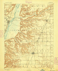
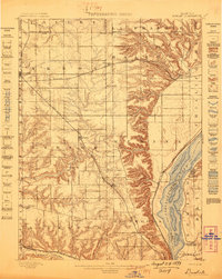
Other maps of this area

1892 · Ottawa
USGS Topo · 1:62,500

1893 · Lacon
USGS Topo · 1:62,500

1893 · Hennepin
USGS Topo · 1:62,500
1893 · Metamora
USGS Topo · 1:62,500

1893 · Dunlap
USGS Topo · 1:62,500

1893 · Lasalle
USGS Topo · 1:62,500
1898 · Dunlap
USGS Topo · 1:62,500

1899 · Clinton
USGS Topo · 1:125,000

1909 · Hennepin
USGS Topo · 1:62,500

1911 · La Salle
USGS Topo · 1:62,500