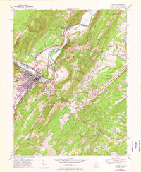
2023 Map of Keyser
USGS Topo · Published 2023About this map
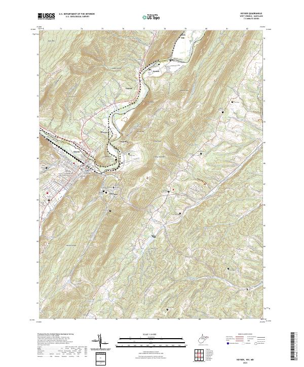
The North Branch Potomac River serves as the winding border between Maryland and West Virginia, carving a deep valley through the ridges of Dans Mtn and New Creek Mountain. In this industrial and educational hub, the city of Keyser centers on the Mineral County Courthouse and the campus of Potomac State College of West Virginia University. The landscape is a complex arrangement of sharp topography and family legacies, evidenced by numerous burial grounds like the Gerstell Family Cem and the Poor Farm Cem. Small agricultural and residential clusters like Limestone, McCoole, and Gerstell are linked by rural routes that follow the narrow level ground between peaks such as Knobly Mountain and Forge Hill, where the Gerstell Farms Airport utilizes a rare flat clearing.
Find a feature on this map
114 named features on this map. Tap any name to fly to it.
Don’t see what you’re looking for? This feature index may not catch every label — zoom into the map to look around manually.
Map Details
Editions of this 2023 Keyser Map
This is the sole edition of this map. No revisions or reprints were ever made.
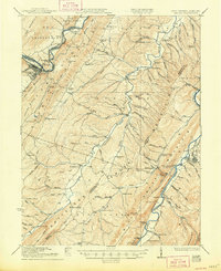
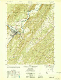
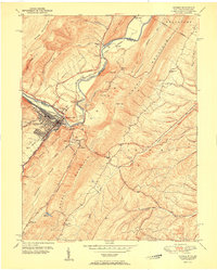
Historical Maps of Forge Hill Through Time
7 maps found