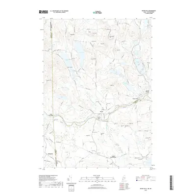
2018 Map of Kezar Falls
USGS Topo · Published 2018About this map
The Ossipee River carves a natural border through this landscape, marking the historic division between York and Oxford counties in Maine. At the center of this riverine corridor, the Porter-Parsonsfield Bridge serves as a critical connection between the settlements of Porter and Kezar Falls. The area is characterized by a high density of small family and community burial grounds, such as Huntress Cem, Trueworthy Cem, and Porter Village Cem, which offer significant genealogical value for those tracing local lineages. The terrain rises sharply away from the river valley toward prominent overlooks like Moulton Ridge and Churchill Hill. Water bodies including Colcord Pond and Bickford Pond dominate the northern reaches, while the western edge captures the New Hampshire state line near East Freedom and Effingham, illustrating the interconnected nature of these border communities.
Find a feature on this map
124 named features on this map. Tap any name to fly to it.
Don’t see what you’re looking for? This feature index may not catch every label — zoom into the map to look around manually.
Map Details
Editions of this 2018 Kezar Falls Map
This is the sole edition of this map. No revisions or reprints were ever made.
Other maps of this area

1891 · Newfield
USGS Topo · 1:62,500

1893 · Newfield
USGS Topo · 1:62,500

1910 · Kezar Falls
USGS Topo · 1:48,000

1911 · Kezar Falls
USGS Topo · 1:62,500

1928 · Wolfeboro
USGS Topo · 1:62,500

1930 · Ossipee Lake
USGS Topo · 1:62,500

1933 · Newfield
USGS Topo · 1:48,000

1937 · Newfield
USGS Topo · 1:62,500

1942 · Newfield
USGS Topo · 1:62,500

1944 · Newfield
USGS Topo · 1:62,500