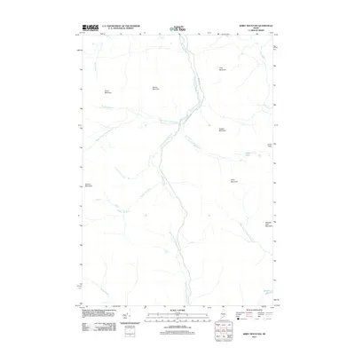
2011 Map of Kibby Mountain
USGS Topo · Published 2011About this map
Kibby Mountain and the surrounding peaks of the Maine boundary mountains define this landscape near the Canadian border. The terrain is a complex hydrologic network where the South Branch Moose River meets tributaries like Hay Bog Brook and West Branch Moose River. This 2011 survey documents a region dominated by timber and topographic relief rather than permanent settlements, with access provided by industrial corridors such as Gold Brook Rd and Beattie Rd. Small water bodies like Prick Pond and Douglas Pond are scattered throughout the high elevations, while the Caribou Flow indicates the drainage patterns between Caribou Mountain and Peaked Mountain. For the historian or surveyor, the map provides a precise record of the headwaters for several major drainage systems, including Kibby Stream and the Middle Branch Kibby Stream.
Find a feature on this map
23 named features on this map. Tap any name to fly to it.
Don’t see what you’re looking for? This feature index may not catch every label — zoom into the map to look around manually.
Map Details
Editions of this 2011 Kibby Mountain Map
This is the sole edition of this map. No revisions or reprints were ever made.
Other maps of this area

1923 · Attean
USGS Topo · 1:62,500

1925 · Attean
USGS Topo · 1:62,500

1928 · Chain Lakes
USGS Topo · 1:48,000

1928 · Skinner
USGS Topo · 1:48,000

1928 · Spencer
USGS Topo · 1:48,000

1931 · Skinner
USGS Topo · 1:62,500

1932 · Spencer
USGS Topo · 1:62,500

1932 · Chain Lakes
USGS Topo · 1:62,500

1935 · Chain Lakes
USGS Topo · 1:62,500

1949 · Jackman
USGS Topo · 1:250,000