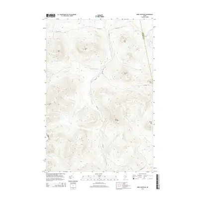
2014 Map of Kibby Mountain
USGS Topo · Published 2014About this map
The Canada Usa border runs along the western edge of this topographic study, where the high ridgelines of the Maine wilderness meet the international boundary. Heavy mountain terrain dominates the landscape, anchored by the significant elevation of Kibby Mountain and the surrounding peaks of Caribou Mtn and Smart Mtn. The area serves as a critical watershed, with the W Br Moose River and S Br Moose River carving through the valleys alongside South Branch Moose River. Human presence is defined primarily by a network of logging and access routes like Lowelltown Rd and Beaudry Rd, which connect the remote summits to the scattered water bodies of the interior. Small alpine features like Prick Pond and the headwaters of Kibby Stream illustrate the complex drainage patterns of this high-country environment.
Find a feature on this map
29 named features on this map. Tap any name to fly to it.
Don’t see what you’re looking for? This feature index may not catch every label — zoom into the map to look around manually.
Map Details
Editions of this 2014 Kibby Mountain Map
This is the sole edition of this map. No revisions or reprints were ever made.
Other maps of this area

1923 · Attean
USGS Topo · 1:62,500

1925 · Attean
USGS Topo · 1:62,500

1928 · Chain Lakes
USGS Topo · 1:48,000

1928 · Skinner
USGS Topo · 1:48,000

1928 · Spencer
USGS Topo · 1:48,000

1931 · Skinner
USGS Topo · 1:62,500

1932 · Spencer
USGS Topo · 1:62,500

1932 · Chain Lakes
USGS Topo · 1:62,500

1935 · Chain Lakes
USGS Topo · 1:62,500

1949 · Jackman
USGS Topo · 1:250,000