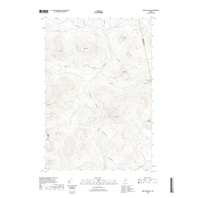
2018 Map of Kibby Mountain
USGS Topo · Published 2018About this map
Kibby Mtn and the surrounding high country define this portion of the Maine wilderness along the international boundary between the USA and Canada. The landscape is dominated by a complex network of watercourses, including the headwaters of the W Br Moose River, S Br Moose River, and Kibby Stream, which carve through the elevations of Caribou Mtn and Moose Mtn. This terrain is accessed via primitive routes such as Gold Brook Rd and Kibby Mountain Rd, reflecting the area's history of logging and backcountry management. The drainage patterns are intricate, featuring localized wetlands like Spencer Bog and the Caribou Flow. Notable peaks like Peaked Mtn and Leroy Peak stand as landmarks in this remote forest environment near the border of Franklin and Somerset Counties.
Find a feature on this map
37 named features on this map. Tap any name to fly to it.
Don’t see what you’re looking for? This feature index may not catch every label — zoom into the map to look around manually.
Map Details
Editions of this 2018 Kibby Mountain Map
This is the sole edition of this map. No revisions or reprints were ever made.
Other maps of this area

1923 · Attean
USGS Topo · 1:62,500

1925 · Attean
USGS Topo · 1:62,500

1928 · Chain Lakes
USGS Topo · 1:48,000

1928 · Skinner
USGS Topo · 1:48,000

1928 · Spencer
USGS Topo · 1:48,000

1931 · Skinner
USGS Topo · 1:62,500

1932 · Spencer
USGS Topo · 1:62,500

1932 · Chain Lakes
USGS Topo · 1:62,500

1935 · Chain Lakes
USGS Topo · 1:62,500

1949 · Jackman
USGS Topo · 1:250,000