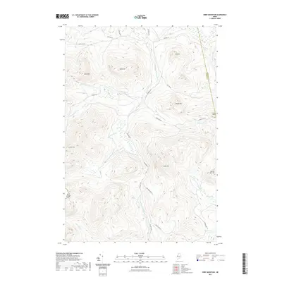
2021 Map of Kibby Mountain
USGS Topo · Published 2021About this map
The international border between the Usa and Canada defines the western edge of this Maine landscape, where the headwaters of several major river systems begin their descent. High peaks such as Kibby Mtn and Caribou Mtn dominate the topography, separated by a complex network of logging and access roads including Goldbrook Rd and Kibby Mountain Rd. The drainage pattern is particularly intricate, with the W Br Moose River and S Br Moose River carving through the highlands. Notable water bodies like Douglas Pond and the marshy Spencer Bog sit in the lower elevations between ridges. This modern survey illustrates how industrial forest management and natural geography coexist along the remote Franklin and Somerset County line, preserving the character of the northern Maine woods.
Find a feature on this map
37 named features on this map. Tap any name to fly to it.
Don’t see what you’re looking for? This feature index may not catch every label — zoom into the map to look around manually.
Map Details
Editions of this 2021 Kibby Mountain Map
This is the sole edition of this map. No revisions or reprints were ever made.
Other maps of this area

1923 · Attean
USGS Topo · 1:62,500

1925 · Attean
USGS Topo · 1:62,500

1928 · Chain Lakes
USGS Topo · 1:48,000

1928 · Skinner
USGS Topo · 1:48,000

1928 · Spencer
USGS Topo · 1:48,000

1931 · Skinner
USGS Topo · 1:62,500

1932 · Spencer
USGS Topo · 1:62,500

1932 · Chain Lakes
USGS Topo · 1:62,500

1935 · Chain Lakes
USGS Topo · 1:62,500

1949 · Jackman
USGS Topo · 1:250,000