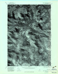
1977 Map of Kibby Mountain
USGS Topo · Published 1983About this map
Kibby Mountain and the surrounding high timberlands of Franklin County are documented here through high-altitude aerial photography. This orthophotoquad reveals a landscape defined by industrial forestry and complex drainage systems, where logging tracks and clearings contrast with the dense canopy of Moose Mountain and Peaked Mountain. The network of watercourses, including the South Branch Moose River and West Branch Moose River, illustrates the hydrologic importance of this Maine-Quebec border region. Unlike traditional topographic maps, this imagery provides a direct look at the forest structure and access roads near Kibby Mountain and along the West Branch Spencer Stream. The inclusion of features like Bog Brook and Middle Branch Kibby Stream offers a precise view of the terrain as it appeared during the late 1970s.
Find a feature on this map
9 named features on this map. Tap any name to fly to it.
Don’t see what you’re looking for? This feature index may not catch every label — zoom into the map to look around manually.
Map Details
Editions of this 1977 Kibby Mountain Map
This is the sole edition of this map. No revisions or reprints were ever made.
Other maps of this area

1923 · Attean
USGS Topo · 1:62,500

1925 · Attean
USGS Topo · 1:62,500

1928 · Chain Lakes
USGS Topo · 1:48,000

1928 · Skinner
USGS Topo · 1:48,000

1928 · Spencer
USGS Topo · 1:48,000

1931 · Skinner
USGS Topo · 1:62,500

1932 · Spencer
USGS Topo · 1:62,500

1932 · Chain Lakes
USGS Topo · 1:62,500

1935 · Chain Lakes
USGS Topo · 1:62,500

1949 · Jackman
USGS Topo · 1:250,000