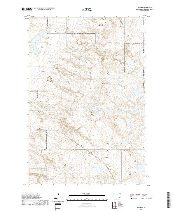
2021 Map of Kidder SE
USGS Topo · Published 2021About this map
The Coteau des Prairies plateau rises across this Marshall County landscape, defining the hydrology of a high prairie region. In the northern reaches, White Lake and the headwaters of Wild Rice Cr drain the glacial terrain, while the southern sections are characterized by more stagnant drainage features such as Black Slough and Stink Slough. The rural grid is anchored by thoroughfares like Co Hwy 6 and local routes including Bremmon Rd and Tory Rd, which navigate the rises and falls of the prairie. The topography is further etched by significant drainage cuts like Crow Cr, Marble Gulch, and Oak Gulch, illustrating the erosion patterns of this distinctive South Dakota landform.
Find a feature on this map
25 named features on this map. Tap any name to fly to it.
Don’t see what you’re looking for? This feature index may not catch every label — zoom into the map to look around manually.
Map Details
Editions of this 2021 Kidder SE Map
This is the sole edition of this map. No revisions or reprints were ever made.
Other maps of this area

1953 · Britton East
USGS Topo · 1:24,000

1953 · Kidder
USGS Topo · 1:24,000

1953 · Milbank
USGS Topo · 1:250,000

1954 · Kidder SE
USGS Topo · 1:24,000

1956 · Havana
USGS Topo · 1:24,000

1958 · Milbank
USGS Topo · 1:250,000

1958 · Britton 4 NW
USGS Topo · 1:24,000

1958 · Hillhead
USGS Topo · 1:24,000

1958 · Marlow
USGS Topo · 1:24,000

1970 · Britton 4 NE
USGS Topo · 1:24,000