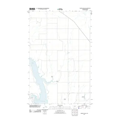
2011 Map of Kiehns Coulee
USGS Topo · Published 2011About this map
Fresno Reservoir dominates the western half of this Hill County landscape, where the Milk River valley was transformed by mid-century water management. The map reveals the intricate drainage patterns of the High Plains, defined by seasonal watercourses such as Miller Coulee, Browns Coulee, and the namesake Kiehns Coulee that cut through the tablelands. On the southern shoreline, Kremlin Bay and Kremlin Campground highlight the area's recreational development. To the east, the rural infrastructure is marked by the John Estate McSlay Dam and a grid of secondary roads like Flagstaff Rd and Supenau Rd, which support the region's agricultural character. This survey provides a clear view of how topographic features and water access shaped the land use and road networks of northern Montana.
Find a feature on this map
14 named features on this map. Tap any name to fly to it.
Don’t see what you’re looking for? This feature index may not catch every label — zoom into the map to look around manually.
Map Details
Editions of this 2011 Kiehns Coulee Map
This is the sole edition of this map. No revisions or reprints were ever made.
Other maps of this area

1904 · Assinniboine
USGS Topo · 1:62,500

1906 · Kremlin
USGS Topo · 1:62,500

1912 · Thibedeau Lake
USGS Topo · 1:125,000

1920 · Gildford
USGS Topo · 1:125,000

1943 · Gildford
USGS Topo · 1:125,000

1953 · Havre
USGS Topo · 1:250,000

1954 · Shelby
USGS Topo · 1:250,000

1957 · Havre
USGS Topo · 1:250,000

1958 · Shelby
USGS Topo · 1:250,000

1958 · Havre
USGS Topo · 1:250,000