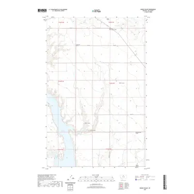
2020 Map of Kiehns Coulee
USGS Topo · Published 2020About this map
Fresno Reservoir defines the southwestern portion of this Hill County landscape, where the waters of Kremlin Bay reach into the prairie. The surrounding terrain is characterized by an intricate network of drainage channels, locally known as coulees, that carve through the high plains. Significant topographic markers include the eponymous Kiehns Coulee and Messerschmidt Coulee to the east, while East Fork Cottonwood Coulee dominates the northern reaches. This 2020 survey illustrates a sparsely populated agricultural region, where the section-line grid of the Public Land Survey System is maintained by rural routes such as N Rd 110 and Rd 40 N. The map provides a clear record of modern land management and water resources, documenting the names of family-held or historically recognized landmarks like Little Dane Coulee and Browns Coulee.
Find a feature on this map
20 named features on this map. Tap any name to fly to it.
Don’t see what you’re looking for? This feature index may not catch every label — zoom into the map to look around manually.
Map Details
Editions of this 2020 Kiehns Coulee Map
This is the sole edition of this map. No revisions or reprints were ever made.
Other maps of this area

1904 · Assinniboine
USGS Topo · 1:62,500

1906 · Kremlin
USGS Topo · 1:62,500

1912 · Thibedeau Lake
USGS Topo · 1:125,000

1920 · Gildford
USGS Topo · 1:125,000

1943 · Gildford
USGS Topo · 1:125,000

1953 · Havre
USGS Topo · 1:250,000

1954 · Shelby
USGS Topo · 1:250,000

1957 · Havre
USGS Topo · 1:250,000

1958 · Shelby
USGS Topo · 1:250,000

1958 · Havre
USGS Topo · 1:250,000