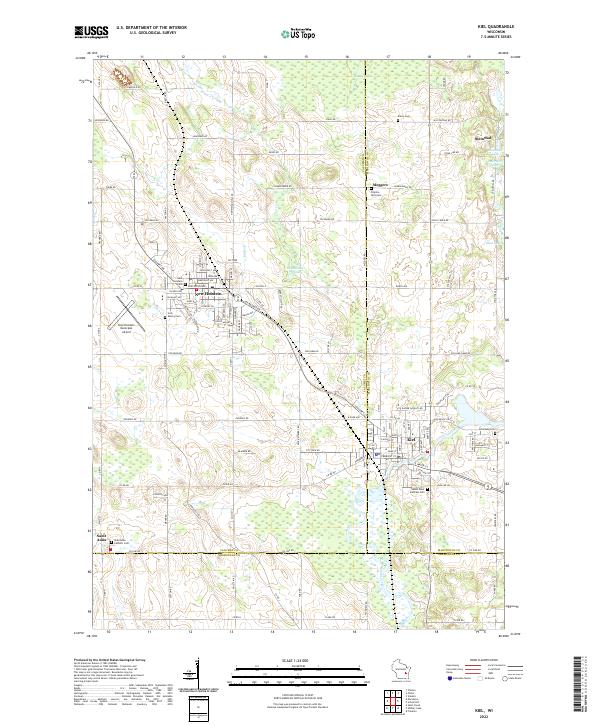
2022 Map of Kiel
USGS Topo · Published 2022About this map
Industrial and agricultural life in the Calumet and Manitowoc borderlands centers on the significant manufacturing and rail corridor between Kiel and New Holstein. This landscape is defined by the sharp transition from the rolling glacial topography near Hayton Marsh to the intricate network of family farms connected by roads like Charlesburg Rd and Tecumseh Rd. The southern portion of the map highlights the winding course of the Sheboygan River as it passes through the southeastern corner of Kiel, while smaller hamlets like Steinthal and Saint Anna anchor the surrounding rural sections.
Find a feature on this map
119 named features on this map. Tap any name to fly to it.
Don’t see what you’re looking for? This feature index may not catch every label — zoom into the map to look around manually.
Map Details
Editions of this 2022 Kiel Map
This is the sole edition of this map. No revisions or reprints were ever made.
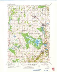
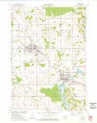
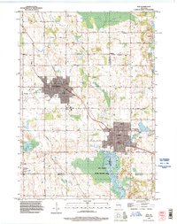
Historical Maps of Schleswig Through Time
4 maps found