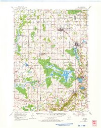
1954 Map of Kiel
USGS Topo · Published 1966About this map
The glacial legacy of eastern Wisconsin is prominently displayed through the expansive Kettle Moraine State Forest and a series of kettle lakes including Elkhart Lake, Crystal Lake, and Sheboygan Lake. This 1950s survey captures a transition in the rural landscape, where established dairy-farming communities like New Holstein, Kiel, and St Cloud are linked by the Chicago and North Western and the Milwaukee St Paul and Pacific railroads.
Find a feature on this map
71 named features on this map. Tap any name to fly to it.
Don’t see what you’re looking for? This feature index may not catch every label — zoom into the map to look around manually.
Map Details
Editions of this 1954 Kiel Map
2 editions found
Other maps of this area

1910 · Fond du Lac
USGS Topo · 1:62,500

1911 · Neenah
USGS Topo · 1:62,500

1954 · Sheboygan Falls
USGS Topo · 1:62,500

1954 · School Hill
USGS Topo · 1:24,000

1954 · Howards Grove
USGS Topo · 1:62,500

1954 · Chilton
USGS Topo · 1:62,500

1954 · Reedsville
USGS Topo · 1:62,500

1954 · Franklin
USGS Topo · 1:24,000

1954 · Kiel
USGS Topo · 1:62,500

1954 · Milwaukee
USGS Topo · 1:250,000