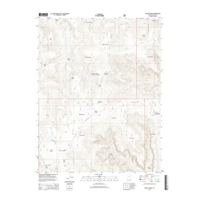
2014 Map of Kigalia Point
USGS Topo · Published 2014About this map
Kigalia Point rises as a prominent landmark within the Manti-Lasal National Forest, anchoring a landscape defined by dramatic geological formations and remote plateaus. This 2014 survey captures the intricate drainage networks of Kigalia Canyon and Arch Canyon, where seasonal water sources like Squaw Water Spring and Squaw Water Hole were essential for the area's early grazing history. The presence of Babylon Pasture and Steamboat Point reflects the nomenclature of early ranching and navigation through this complex terrain.
Find a feature on this map
41 named features on this map. Tap any name to fly to it.
Don’t see what you’re looking for? This feature index may not catch every label — zoom into the map to look around manually.
Map Details
Editions of this 2014 Kigalia Point Map
This is the sole edition of this map. No revisions or reprints were ever made.
Other maps of this area

1886 · Abajo
USGS Topo · 1:250,000

1892 · Abajo
USGS Topo · 1:250,000

1893 · Abajo
USGS Topo · 1:250,000

1935 · Elk Ridge
USGS Topo · 1:96,000

1940 · Elk Ridge
USGS Topo · 1:125,000

1954 · Elk Ridge 4 NW
USGS Topo · 1:24,000

1954 · Elk Ridge 1 SW
USGS Topo · 1:24,000

1954 · Elk Ridge 2 SE
USGS Topo · 1:24,000
1954 · Elk Ridge 3 SW
USGS Topo · 1:24,000

1954 · Elk Ridge 3 NE
USGS Topo · 1:24,000