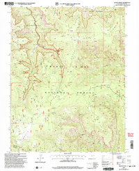
2001 Map of Kigalia Point
USGS Topo · Published 2004About this map
Elk Ridge serves as the central spine for this high-elevation landscape in San Juan County, Utah, where deep drainage systems like Hammond Canyon and Butts Canyon carve through the plateau. Revised by the USDA Forest Service in 2001, the map details the primitive infrastructure of the South Manti-La Sal National Forest, emphasizing a network of 4WD roads that connect isolated landmarks. Significant natural features include the Dark Canyon Wilderness and the iconic Bears Ears twin peaks in the southwest. Historical land use is evident in the scattered Corrals and namesake points like Kigalia Point. Researchers will find specific natural monuments documented, such as Keystone Arch, alongside grazing-related sites like Babylon Pasture and vital water sources including Squaw Water Hole and Squaw Water Spring.
Find a feature on this map
48 named features on this map. Tap any name to fly to it.
Don’t see what you’re looking for? This feature index may not catch every label — zoom into the map to look around manually.
Map Details
Editions of this 2001 Kigalia Point Map
This is the sole edition of this map. No revisions or reprints were ever made.
Other maps of this area

1886 · Abajo
USGS Topo · 1:250,000

1892 · Abajo
USGS Topo · 1:250,000

1893 · Abajo
USGS Topo · 1:250,000

1935 · Elk Ridge
USGS Topo · 1:96,000

1940 · Elk Ridge
USGS Topo · 1:125,000

1954 · Elk Ridge 4 NW
USGS Topo · 1:24,000

1954 · Elk Ridge 1 SW
USGS Topo · 1:24,000

1954 · Elk Ridge 2 SE
USGS Topo · 1:24,000
1954 · Elk Ridge 3 SW
USGS Topo · 1:24,000

1954 · Elk Ridge 3 NE
USGS Topo · 1:24,000