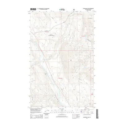
2014 Map of Kilbrennan Lake
USGS Topo · Published 2014About this map
Yakt is positioned along the Kootenai River in this northern Montana landscape, where the river's path is carved through the towering Purcell Mountains. The confluence of the Yaak River and the Kootenai creates a distinct valley structure, largely contained within the protected lands of the Kootenai National Forest. This 2014 survey reveals a rugged geography defined by numerous tributary streams, including O'Brien Creek and Ruby Creek, which drain the surrounding highlands toward the primary river systems. To the east, the terrain rises toward Yaak Mountain, while pockets of water like Kilbrennan Lake and Alvord Lake provide localized geographical anchors. The forest road network, including the ANC Creek Rd and Yaak River Rd, illustrates the access patterns developed for timber management and backcountry navigation in this portion of Lincoln County.
Find a feature on this map
24 named features on this map. Tap any name to fly to it.
Don’t see what you’re looking for? This feature index may not catch every label — zoom into the map to look around manually.
Map Details
Editions of this 2014 Kilbrennan Lake Map
This is the sole edition of this map. No revisions or reprints were ever made.
Other maps of this area

1911 · Priest Lake
USGS Topo · 1:250,000

1913 · Priest Lake
USGS Topo · 1:250,000

1920 · Libby
USGS Topo · 1:125,000

1930 · Libby
USGS Topo · 1:125,000

1932 · Libby
USGS Topo · 1:125,000

1951 · Mt Pend Oreille
USGS Topo · 1:62,500

1957 · Kalispell
USGS Topo · 1:250,000

1958 · Sandpoint
USGS Topo · 1:250,000

1960 · Kalispell
USGS Topo · 1:250,000

1961 · Kalispell
USGS Topo · 1:250,000