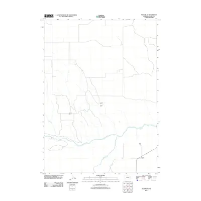
2011 Map of Kilgore SE
USGS Topo · Published 2011About this map
The confluence of the Snake River and the Niobrara River dominates this section of the Nebraska Sandhills, where deep canyons and high flats define the remote ranching landscape. Evidence of the area's pioneer heritage is visible in the naming of German Settlement Rd, which cuts through the northwestern portion of the map. This 2011 survey documents the continued footprint of traditional western land use, showing established property holdings like the Schlueter Ranch, Dittmer Ranch, and Bush Ranch.
Find a feature on this map
10 named features on this map. Tap any name to fly to it.
Don’t see what you’re looking for? This feature index may not catch every label — zoom into the map to look around manually.
Map Details
Editions of this 2011 Kilgore SE Map
This is the sole edition of this map. No revisions or reprints were ever made.
Other maps of this area

1950 · Simeon
USGS Topo · 1:62,500

1950 · Kennedy
USGS Topo · 1:62,500

1950 · Kilgore
USGS Topo · 1:62,500

1950 · Valentine
USGS Topo · 1:62,500

1957 · Valentine
USGS Topo · 1:250,000

1959 · Valentine
USGS Topo · 1:250,000
1983 · Crookston East
USGS Topo · 1:24,000

1983 · Valentine SW
USGS Topo · 1:24,000
1985 · Kilgore SE
USGS Topo · 1:24,000

1985 · Cooper Canyon
USGS Topo · 1:24,000