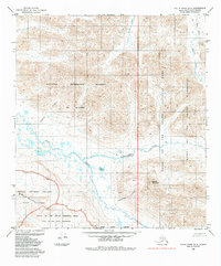
1984 Map of Killik River A-5
USGS Topo · Published 1984About this map
The Nigu River and its labyrinth of northern tributaries define this mid-1980s landscape within the North Slope Borough. This region represents a complex intersection of federal land management established by the Alaska National Interest Lands Conservation Act of 1980. The map illustrates the meeting point of the National Petroleum Reserve in Alaska with the protected expanses of Gates of the Arctic National Park and the Noatak National Preserve.
Find a feature on this map
15 named features on this map. Tap any name to fly to it.
Don’t see what you’re looking for? This feature index may not catch every label — zoom into the map to look around manually.
Map Details
Editions of this 1984 Killik River A-5 Map
This is the sole edition of this map. No revisions or reprints were ever made.
Other maps of this area

1951 · Survey Pass
USGS Topo · 1:250,000

1951 · Howard Pass
USGS Topo · 1:250,000

1951 · Ambler River
USGS Topo · 1:250,000

1951 · Killik River
USGS Topo · 1:250,000

1956 · Survey Pass
USGS Topo · 1:250,000

1956 · Howard Pass
USGS Topo · 1:250,000

1956 · Killik River
USGS Topo · 1:250,000

1956 · Ambler River
USGS Topo · 1:250,000

1964 · Survey Pass
USGS Topo · 1:250,000

1964 · Ambler River
USGS Topo · 1:250,000