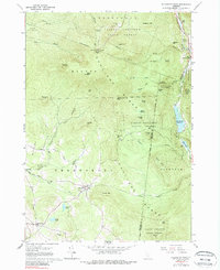
1961 Map of Killington Peak
USGS Topo · Published 1988About this map
The high ridges of the Coolidge Range dominate this mid-century look at the Green Mountains, where the legendary Long Appalachian Trail snakes across summits like Killington Peak and Shrewsbury Peak. The map captures a landscape defined by the intersection of mountain recreation and small-town Vermont life, with the Calvin Coolidge State Forest encompassing much of the terrain.
Find a feature on this map
63 named features on this map. Tap any name to fly to it.
Don’t see what you’re looking for? This feature index may not catch every label — zoom into the map to look around manually.
Map Details
Editions of this 1961 Killington Peak Map
Other maps of this area

1891 · Rutland
USGS Topo · 1:62,500

1893 · Wallingford
USGS Topo · 1:62,500

1893 · Rutland
USGS Topo · 1:62,500

1911 · Woodstock
USGS Topo · 1:62,500

1913 · Woodstock
USGS Topo · 1:62,500

1928 · Ludlow
USGS Topo · 1:48,000

1929 · Ludlow
USGS Topo · 1:62,500

1932 · Ludlow
USGS Topo · 1:62,500

1943 · Woodstock
USGS Topo · 1:62,500

1950 · Glens Falls
USGS Topo · 1:250,000