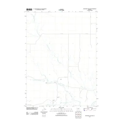
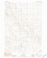
2011 Map of Kilpatrick Lake NW
USGS Topo · Published 2011About this map
North Branch Snake Creek and South Branch Snake Creek wind through this corner of Sioux County, defining a landscape shaped by ranching and intermittent watercourses. The 2011 survey reveals a settlement pattern focused on established agricultural holdings, including the Hood Ranch, Hall Ranch, and Locker Ranch. This area of western Nebraska relies on a grid of rural roads such as Jefferson Rd and Henderson Rd to connect these isolated homesteads across the plains. In the southern portion of the quadrangle, the drainage of Mud Springs Creek (also labeled Mud Springs Crk) provides another focal point for local geography. The presence of the B Henderson Ranch and E Henderson Ranch underscores the importance of family-named landmarks in documenting the land use and genealogy of this ranching community.
Find a feature on this map
14 named features on this map. Tap any name to fly to it.
Don’t see what you’re looking for? This feature index may not catch every label — zoom into the map to look around manually.
Map Details
Editions of this 2011 Kilpatrick Lake NW Map
This is the sole edition of this map. No revisions or reprints were ever made.
Other maps of this area

1899 · Whistle Creek
USGS Topo · 1:125,000

1951 · Marsland
USGS Topo · 1:62,500

1951 · Kilpatrick Lake
USGS Topo · 1:62,500

1955 · Alliance
USGS Topo · 1:250,000

1957 · Alliance
USGS Topo · 1:250,000

1958 · Alliance
USGS Topo · 1:250,000
1983 · Marsland SE
USGS Topo · 1:24,000
1983 · University Lake SE
USGS Topo · 1:24,000
1983 · Kilpatrick Lake
USGS Topo · 1:24,000
1983 · Kilpatrick Lake NW
USGS Topo · 1:24,000