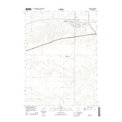
2014 Map of Kimball
USGS Topo · Published 2014About this map
The high plains of the Nebraska Panhandle center on Kimball, a community defined by its grid of streets such as S High School St and S Chestnut St. This landscape is heavily shaped by water management, featuring a sophisticated network of irrigation and storage including the Kimball Canal and Lodgepole Cr. Several prominent local water bodies, such as Janicek Reservoir, Cederburg Reservoir, and the Yung North Reservoir and Yung South Reservoir pair, reflect the agricultural importance of water catchment in this semi-arid region. To the south, the Kimball Municipal Airport/Robert E Arraj Field stands as a significant landmark. The presence of Stahlas North Court and various county roads, including Old NE-71, illustrates the modern transportation infrastructure that supports this western Nebraska hub.
Find a feature on this map
56 named features on this map. Tap any name to fly to it.
Don’t see what you’re looking for? This feature index may not catch every label — zoom into the map to look around manually.
Map Details
Editions of this 2014 Kimball Map
This is the sole edition of this map. No revisions or reprints were ever made.
Other maps of this area

1954 · Scottsbluff
USGS Topo · 1:250,000

1958 · Scottsbluff
USGS Topo · 1:250,000

1972 · Owasco
USGS Topo · 1:24,000

1972 · Kimball SE
USGS Topo · 1:24,000

1972 · Kimball SW
USGS Topo · 1:24,000

1972 · Kimball
USGS Topo · 1:24,000

1972 · Bushnell SE
USGS Topo · 1:24,000

1972 · Oliver Reservoir
USGS Topo · 1:24,000

1973 · Kimball 2 SE
USGS Topo · 1:24,000

1973 · Kimball 1 SE
USGS Topo · 1:24,000